Getting There:
GPS Info. (Latitude, Longitude):45.50045, -110.58616
45°30'2"N, 110°35'10"W
-




|
Find your spot
/-110.5861611,45.50045,8,0/280x200?access_token=pk.eyJ1IjoiYXNwaXJhLW1hcHMiLCJhIjoiY2tlYmxiaWt3MDMwcTJ5cDN5bGwzZTUwNCJ9.IK2OEvl3EWmVLXYD9Rnedw "Find other facilities on map") 
|
 Description
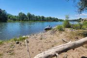
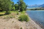
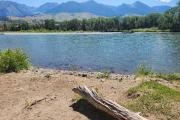
Siskin Island Fishing Access Site (FAS) is on the Upper Yellowstone River about 500 yards upstream from Pine Creek FAS and two river miles downstream from Mallard’s Rest FAS.
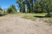
Geography: The island features a rocky shoreline, mature cottonwood forests, willow thickets, marsh wetlands and open meadows that provide habitat for a variety of wildlife including waterfowl, songbirds, white-tailed deer, beaver, otters, and fish. Mule deer and elk occasionally pass through the property. The island complex and associated side channels within the Yellowstone River supports spawning and rearing habitat for trout in addition to a variety of game and non-game fish and wildlife species. Alerts and Important Information Food storage rules apply. Food storage required. All food, trash and scented items must be stored in an IGCB approved bear resistant container or hung properly when not in use Pack out all garbage. Please report any bear encounters within a float-in campsite to FWP. It is recommended that you carry bear spray and be bear aware. Fire Pans required for all fires, and ash packed out. Portable Toilet required, and human and pet waste packed out. No campfires except in designated campsites. No firewood cutting. No glass containers/bottles A Montana Conservation License is required for the use of Fishing Access Sites. Getting There:GPS Info. (Latitude, Longitude):45.50045, -110.58616 45°30'2"N, 110°35'10"W - Contact Information:
Mailing Address: Siskin Island FAS1400 S 19th Ave Bozeman MT 59718 Phone Number: Project Office:
(406)577-7900 |